2003 W1 / W2 / W3 Map Analysis
This map is a key exhibit because it shows facilities visually rather than merely describing them in narrative form.
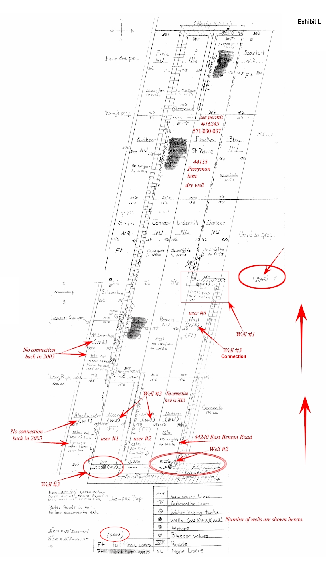
Verified from image: the exhibit identifies W1, W2, and W3. Unknown from this image alone: the document that formally combines those facilities into a single regulated water system.
Why It Matters
If later records use one-system language, this map requires the reader to ask what document explains that treatment.
Controlling Question
What earlier document gave later authors the basis to make the single-system assumption?